Tuesday, December 6, 2016

Ilha do Mel


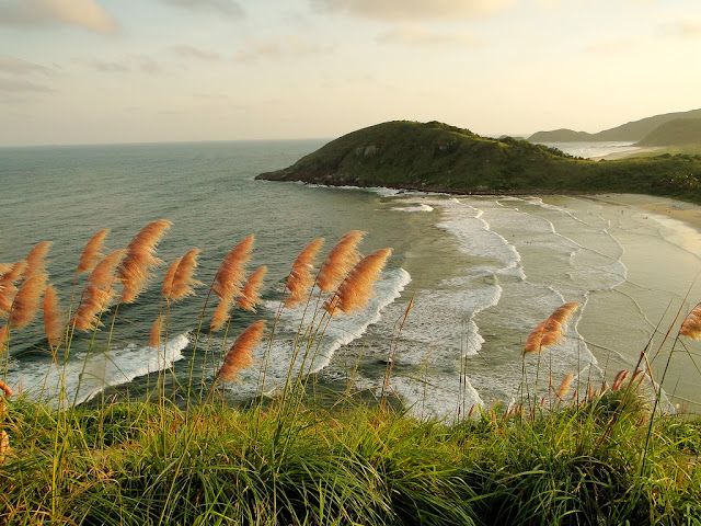
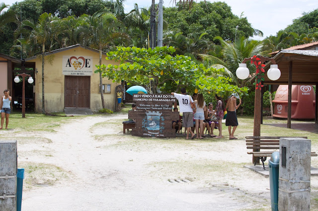
This hourglass-shaped island at the mouth of the Baía de Paranaguá is the most pristine and picturesque beach resort in all of southern Brazil, offering mostly wild beaches, good surfing waves and scenic coastal walks. The island’s tranquility and lack of development are thanks in part to its isolation. Accessible only by boat, Ilha do Mel is traversed by sandy paths and has not a single car, so traffic jams throughout the island’s scenic sandy lanes consist of surfboard-toting Brazilians on bicycles and bedazzled foreigners in their new Havaianas.

The fatter, northern half of the island is an ecological preserve, closed to inland exploration. The hillier southern portion is the locale of three small villages: Nova Brasília and Praia do Farol near the isthmus; and Encantadas at the far southern tip. They can be rowdy during the summer holidays, when young crowds descend on the island. But for the most part, Ilha do Mel, or ‘honey island,’ is the territory of surfers, campers, beachcombers and other escapists in search of simplicity and serenity.
Photo Flickr by ferias de mochila

Photo Flickr by jessica pirovani

Photo Flickr by Michel Adamo

Photo Flickr by Sergio Gonçalves


Source: lonelyplanet 

Saturday, November 12, 2016

Vila Velha State Park


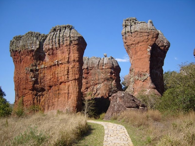
It's a state park in Paraná State, Brazil. It covers 3,803 hectares (9,400 acres). Over one million years, ice-age glaciers and wind erosion worked together to sculpt Vila Velha's unique rock formations.

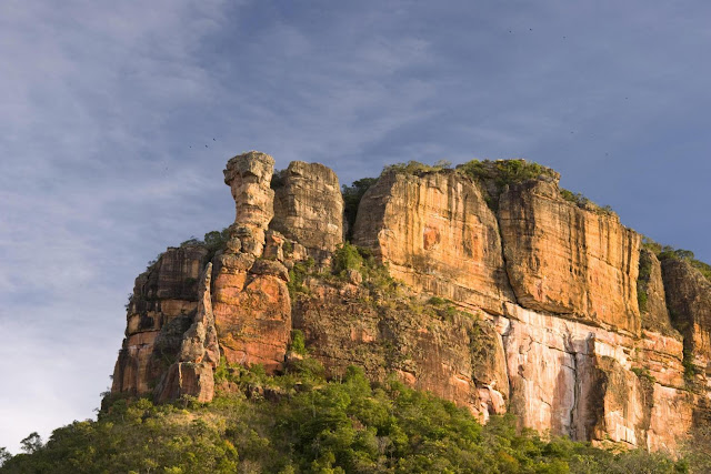
The Vila Velha State Park, near Ponta Grossa, Brazil, is famous for its strange prehistoric looking limestone sculptured rocks. Nick named the “lost stone city,” sentinel-like sandstone figures resembling animals, humans and other shapes that can been seen in these unique formations. 

The park is located about 90km (55 miles) from Curitiba. It was created in 1953 and was listed as a State heritage in 1966.

The Vila Velha State Park is open from Wednesday to Monday and has recently been completely restructured.

The main attractions are the sandstone sculptures and Dourada Lake. The former elevators inside the Furnas Caves are no longer open to the public, in a conservation effort to protect the endangered animal and plant life which inhabit them. However, this stone formations can be observed from outside and is quite impressive. 

Park tours are conducted in minibuses under the supervision of a local guide. A visit lasts approximately three hours and gives you the opportunity to visit the rock formations on foot.

On one side of the loop road there are wide-open, native grasslands, while the other side is covered by the dense, humid vegetation of an Araucaria forest - an incredibly interesting contrast. You should plan for the tour to last six hours (round trip).


Photo by grayline


Photo by grayline

The Goblet" is the symbol of Vila Velha State Park. Photo by grayline
Photo by udiviagens

Dourada Lake: notable for its crystalline waters, approximately 300m in diameter and two or three meters deep, whose bottom is made of mica or malacacheta, feeds from the water of the furnas, through subterranean channels.

Photo by udiviagens


Saturday, October 29, 2016

Dutch colonies in southern Brazil


Carambeí, the first Dutch settlement in the area of Campos Gerais was founded in 1912 and today, together with Castrolanda (one of the cities of Castro, Paraná), is the biggest producer of milk in Brazil. The cooperatives are also very important for the economy in this area of Paraná.

The first Dutch arrived with their families to settle in the former farm Carambehy to sell milk and food to the railroad workers.

Now, the local population strives to keep the Dutch traditions alive. An example of this is the great “Parque Histórico de Carambeí”, an open air museum to preserve the heritage of these pioneers. Spread over 100 thousands sqm, you can see how the houses, the school, kitchen, dairy production, church and even the cemetery used to be! The park is very interesting and the landscape is very beautiful. Bring your camera for great pictures here!


Photo by wikimedia
Castrolanda is another Dutch settlement, founded between 1951 and 1954. Here you will have the chance to visit the biggest windmill outside Holland – part of the Immigration Memorial.

With the end of the World War II, Europe was devastated and many families from Holland left their country in 1951 to come to Paraná with all their equipment and first cows and bulls. They settled down along the Iapó river and founded Castrolanda in an area of 5000 hectares. Later they created the cooperative of same name. The development of this area is thanks to the great work of these pioneers, who adapted to Brazil very fast and are very important to the country.

Its economy is based on agricultural production and dairy farming which is one of the most important in this region that is considered the largest dairy in Brazil due to their genetic quality. It has a considerable production of grain, mostly soy and beans. Also having one of the largest agricultural cooperatives in Brazil, which bears the name of the colony. (wikipedia)

You will learn more about the settlement in the Dutch Immigration Memorial, built in 2001 to celebrate Castrolanda's 50th anniversary. The Immigrant Museum was also opened in 1991 and there you will see objects brought from Europe and used by the pioneers.


Witmarsum

Located only 60 km from Curitiba and 62 km from Ponta Grossa, the Witmarsum colony was founded in 1951 by Mennonite immigrants and is located in Palmeira municipality. With much effort and dedication, the settlement is today known for its fine cheese production and other dairy products. It is a quiet rural settlement where the menonites and German traditions are kept alive.

Tourists are very welcome here and you will have the chance to taste the local dishes and see the manicured gardens and plantations. The local museum is located in the former farm house that hosted the first settlers.

Source: specialparana  Photos by Google and specialparana


Friday, October 21, 2016

Iguazu Falls


The magnificent spectacle of these 275 individual drops has awed tourists, locals and indigenous inhabitants for centuries. They originate from the Iguazu River and are located on the border of Brazil (in the state of Paraná) and Argentina.

In fact, the Iguazu Falls are what divides the river of the same name into its upper and lower portions, a fact that has given rise to several myths and legends as to their origin. This river forms the boundary between Brazil and Argentina, making it a significant part of the political and geographical structure of the continent of South America.

Today, the Iguazu Falls are owned by the two UNESCO World Heritage Sites: the Iguazú National Park in Argentina and the Iguaçu National Park in Brazil.

On the Brazilian side, the best-known falls include:

• Benjamin Constant

• Deodoro

• Floriano

The Iguazu Falls stretch in width for 2.7 kilometers (or 1.7 miles). Their height varies between 60 metres (200 feet) and 82 meters (or 269 feet). This makes the Iguazu Falls taller than Niagara Falls and twice as wide.

A large proportion of the water is thrust down Devil’s Throat, a long chasm that is 82 meters high, 150 metres wide and 700 metres long. This chasm has a distinguishing U-shape. Interestingly, there are several islands within the river and the falls.

In terms of accessibility, tourists need to confirm the possible VISA requirements when entering from either the Brazil or the Argentina side, as the falls comprise both countries. Visitors can reach the falls from Foz do Iguaçu in Brazil and Puerto Iguazú in the Argentina, or from Ciudad del Este in Paraguay.

Special walkways have been built around the Iguazu Falls to allow visitors to get close up to this wonder of their natural beauty and power. A long pathway along the canyon (on the Brazilian side of the falls) is complemented by helicopter flips over the water to allow a completely uninterrupted, unlimited experience of the splendor of Iguazu. Buses of visitors arrive frequently, and travelers are encouraged to arrange such tours well in advance to secure their trip.

The Iguazu Falls are so exquisite that they have been used as the backdrop for many films, including Happy Together (1997), Mr. Magoo (1997), Miami Vice (2006) and Indiana Jones and the Kingdom of the Crystal Skull (2008).

Visitors to Brazil are advised to see the Iguazu Falls during spring or autumn, as summer is very hot and humid, while the water level drops considerably in the winter.

Source: brazilorg


All Images by Google.

Tuesday, October 11, 2016

Curitiba, the beautiful Paraná capital!

Today Curitiba boasts more than 50 sq metres of green space per person. Photograph: Alamy
 Curitiba is the capital and largest city of the southern Brazilian state of Paraná and it's is an important cultural, political, and economic center in Latin America. The city sits on a plateau at 932 meters (3,058 ft) above sea level.

In the 1700s Curitiba possessed a favorable location between cattle-breeding country and marketplaces, leading to a successful cattle trade and the city's first major expansion. Later, between 1850 and 1950, it grew due to logging and agricultural expansion in the Paraná State (first Araucaria logging, later mate and coffee cultivation and in the 1970s wheat, corn and soybean cultivation). In the 1850s waves of European immigrants arrived in Curitiba, mainly Germans, Italians, Poles and Ukrainians, contributing to the city's economic and cultural development. Nowadays, only smaller numbers of foreign immigrants arrive, primarily from Middle Eastern and other South American countries.

The biggest expansion occurred after the 1960s, with innovative urban planning that changed the population size from some hundreds of thousands to more than a million people.

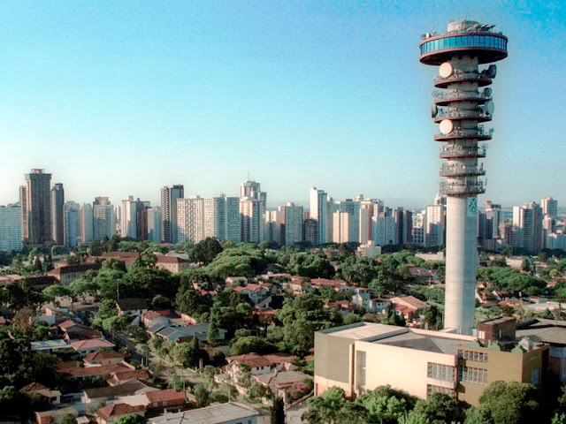
Notable skyline features include the Panoramic Tower, with an observatory on top. Known as a cultural center, Curitiba is home to a number of performance venues, including the Wire Opera House, a structure of tubular steel with a transparent roof, and the huge Guaíra Theater, with diverse programs. source: wikimedia 

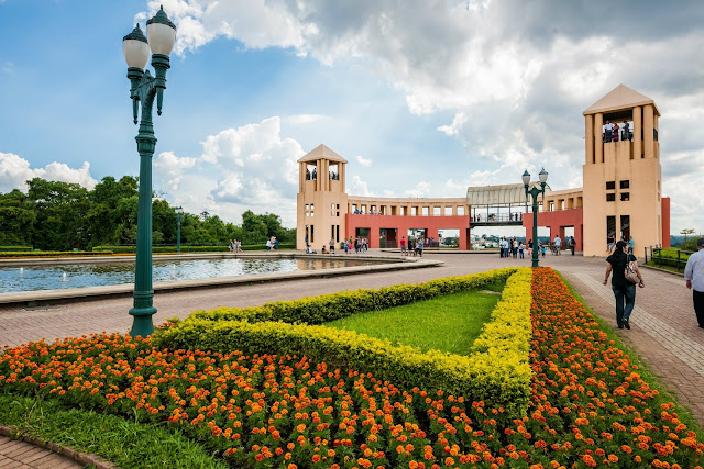
Tanguá Park. It was built on top of a complex of deactivated quarries. It is part of the Barigüi river preservation project joining.The park has a cooper and bicycle track, snack bar, belvedere and Poty Lazzaroto garden. Photo: Google

City Hall. Photo: wikimedia
Portugal Park.
  • Portugal Wood: Homage to the Portuguese-Brazilian bonds, this space is highlighted by a track following a small brook, where one can see drawn on tiles excerpts from famous Portuguese language poets, as well as a tribute to the great Portuguese navigators and their discoveries.
Photo: wikimedia

Panoramic Tower: The 360-foot tall lookout tower allows travelers a 360° view of Curitiba and has a telephone museum on the ground floor. Photo: Google
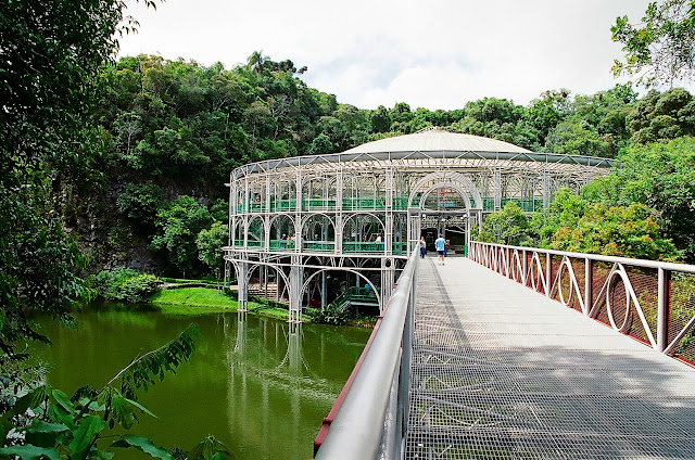
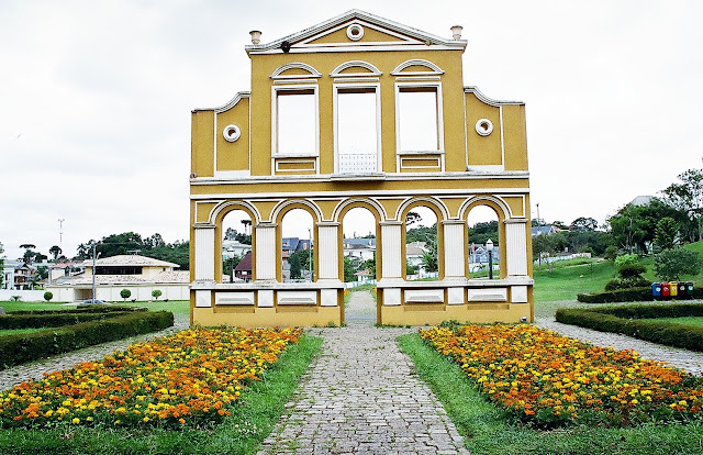
Arch in German Memorial. German Woods: Opened in 1996, the German Grove honors the culture and traditions that German immigrants brought to Curitiba. It is a memorial to those immigrants who arrived in the city from 1833 and greatly contributed to the lifestyle of Curitiba. The grove has many other attractions. The Oratory Bach, a hall for concerts. The Tower of the Philosophers, with a gazebo. The Hansel and Gretel trail. The Haunted house, with a children's library. The Square of the German Culture. In addition to the native forest woods and freshwater springs. Photo: wikimedia

Wire Opera House: Built on the site of an abandoned quarry. Photo: Google

Wire Opera House (inside). Photo: wikimedia

Ukrainian memorial at Tingui Park. Photo: wikimedia

Tingui Park. Photo: Google

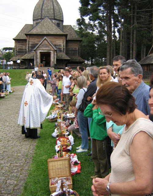
Brazilians of Ukrainian descent celebrating Easter in Curitiba. Ceremony blessing the food.

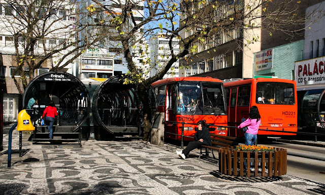
Curitiba has long garnered praise for being one of the world’s best models of urban planning. If it weren’t for the bold initiatives of its three-term mayor, Jaime Lerner, whose daring moves in early 1970s – transforming a six-block length of the downtown into a pedestrian zone (done in secret under the cover of darkness), creating five express-bus avenues with futuristic tubular boarding platforms, encouraging recycling and sustainable design long before it was fashionable and planting trees and creating parks on an enormous scale – Curitiba would probably resemble any other Brazilian city.
Instead, it’s the envy of urban planners the world over and Brazil’s most efficient city. Today, it’s easier to get around Curitiba than any other large city in Brazil. The city has also taken innovative approaches to urban ills such as homelessness, pollution and poverty. Today, the city ensures an above-average quality of life for Brazil. With its abundant green spaces, sophisticated population and well-heeled infrastructure, Curitiba is not a bad spot to recharge your batteries and soak in Brazil at its functioning best. source: lonelyplanet
Curitiba became a model for quality public transport, with policies including the rapid bus transit system. Photograph: Alamy

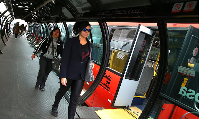
Curitiba’s futuristic ‘tube’ station system for buses. Photograph: Alamy
New system of raised platforms (the futuristic “tube” station system for which Curitiba has grown famous) that allow passengers to move straight from the station into the bus without the hassle of stairs; longer buses to add extra capacity to the fleet; and a system of pre-payment so that bus drivers do not have to issue tickets and collect money on the go. (theguardian)

The city also offers tourists the opportunity to visit good museums, parks with surprising beauty, such as Barigui and Botanical Gardens.
According to Lerner: ‘When you look at the parks the architecture is just great, because it is silent architecture.’ Photograph: Alamy

Botanical Garden
Botanical Gardem.
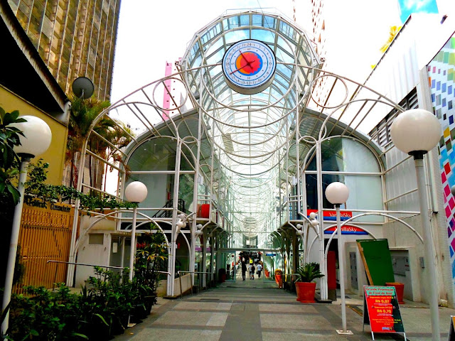
  • Botanical Garden: Besides having a treasure trove of native plants, the Curitiba Botanical Garden is also known for its greenhouse, made of iron and glass and inspired in London's Crystal Palace. Families are often seen picnicking on the grounds.Curitiba’s landmark was inaugurated in 1991. Photo: wikimedia
Among the things that offer residents a good quality of living are its wide tree lined streets, leisure areas, planned industrial districts and residential neighborhoods that have what one expects from a modern and cosmopolitan metropolis.

Rua das Flores/Street
Located in Curitiba City Center, it was the first pavement for pedestrians in the country and is one of the symbols of the town's cultural revolution

Rua 24 Horas
Place for shopping, leisure and restaurants. Downtown.

Guaíra Theatre
One of the biggest theatres in Latin America

Oscar Niemeyer Museum
One of Brazil’s biggest and most modern museums. Designed by Oscar Niemeyer, the “eye” as it is called, is the conclusion of an old piece of work, built by the architect himself in 1976. This exotic, eye-shaped museum is painted with whimsical dancing figures in bold colors. Rotating exhibits highlight Brazilian and international artists of the 20th and 21st centuries; and there's an excellent permanent exhibit on Niemeyer himself. Free admission on the first Sunday of the month and after 6pm on the first Thursday of the month (when the museum closes at 8pm)

Iguaçu Falls. There are 275 falls surrounded by a simply breathtaking scenario. It is 637 km away from Curitiba.

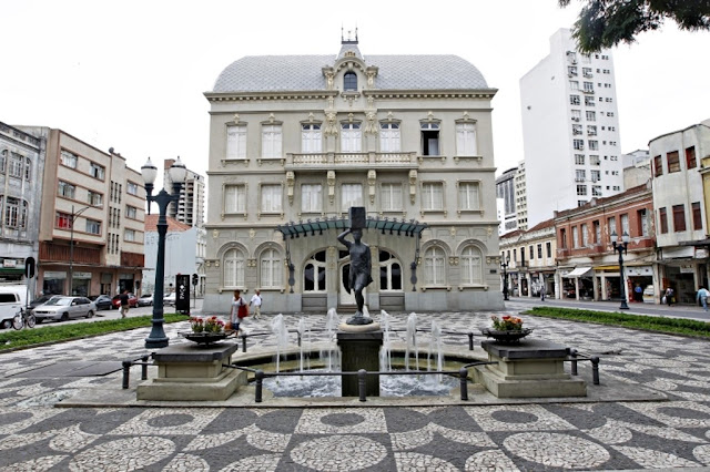
Paço da Liberdade: Former municipal government headquarters. It is the only building in Curitiba to be listed at the three levels: federal, state and municipal and currently, houses a cultural center.